GEOCODE Procedure

Overview: GEOCODE Procedure
About the GEOCODE Procedure
Geocoding is the process
of adding geographic coordinates (latitude and longitude values) to
an address. This process provides a way to convert address data into
map locations. The geographic coordinates typically represent the
center of a ZIP code, a city, an address, or any geographic region.
After geocoding, the coordinates can be used to display a point on
a map or to calculate distances. Geocoding also enables you to add
attributes values such as census blocks to an address.
The GEOCODE procedure
processes geographic information for the following entities:
-
Note: The process of adding coordinates for IP addresses is usually called geolocating. IP data is a form of range data and was not designed to be geographic. For more information, see Understanding Range Geocoding .
About the Required Input Data
The GEOCODE procedure
requires two types of SAS data sets:
contain variables that
relate to specific geographic locations. For example, a data set might
contain mailing address variables such as ZIP codes and street addresses,
or custom geographic variables such as sales regions.
contain reference variables
and geographic coordinates. For example, a lookup data set for the
ZIP method contains ZIP codes and the geographic coordinates that
are associated with the ZIP codes. Some geocoding methods require
multiple lookup data sets. This data is essential to transform address
data into location information that can be viewed on a map.
For each observation
in the input data set, the GEOCODE procedure attempts to match the
address variable value to a value in the lookup data set. To increase
the chances of a match, default lookup variable values in lookup data
sets supplied by SAS are always normalized; uppercased with special
characters and spaces removed. These data sets are either available
with the SAS release or available for download from the SAS Maps Online
Web site.
If you choose to geocode
with any non-default lookup variable that is contained in a lookup
data set supplied by SAS, there is a significantly decreased chance
of matching data.
The GEOCODE procedure
normalizes the default lookup variable values in lookup data sets
that are not supplied by SAS.
The GEOCODE procedure
is not shipped with all the lookup data that you might require. In
some cases, you must download or purchase the data. You can download
lookup data sets from the SAS Maps Online Web site. For more information,
see SAS Maps Online Web Site.
SAS provides macro code
programs to import some third-party data. These macros can be modified
to import data from additional sources. Example
macros are %TIGER2GEOCODE, %ABS2GEOCODE, and %CODEPOINT2GEOCODE.
The macros and their accompanying documentation are available for
download from the SAS Maps Online Web site. For more information,
see SAS Maps Online Web Site.
See Also
%TIGER2GEOCODE macro
code program for importing TIGER shapefiles for specific states and
counties is described in Obtaining Street Lookup Data Sets
%ABS2GEOCODE and %CODEPOINT2GEOCODE
macro code programs for importing postcode data from other countries
are described in Non-U.S. Postcodes
SAS Maps Online Web Site
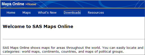
The SAS Maps Online
Web site contains map-related information for areas throughout the
world. You can easily locate and identify specific regions in each
of the following categories: world maps, continents, countries, and
maps of political groups.
-
The SAS Maps Online Web site can be accessed at www.sas.com/mapsonline

About the Output Data
The GEOCODE procedure
adds matching geographic coordinates to the observations in the output
data set. In addition, the GEOCODE procedure adds a variable named
_MATCHED_ that indicates how the coordinates were found. You can also
choose to add variables from the lookup data set to the output data
set by using the ATTRIBUTEVAR= option.
For more information,
see Understanding Output Data.
Deciding Which Lookup Data to Use
The type of geocoding
you want to do determines the type of lookup data that is required.
Granularity of information is an important consideration in determining
which geocoding process to use. For example, does the location need
to be an actual house location, or is a ZIP code or even a city sufficient?
If you are viewing the addresses on a state or U.S. map, then the
ZIP code or city location is probably accurate enough.
The age of the lookup
data also affects your decision. How current does the data need to
be? Street address data frequently changes with the addition of new
roads and changes to postal codes. The older your lookup data, the
more likely it is that some address matches might be incorrect or
missed completely. On the other hand, city and state lookup data do
not change as often.
The more up-to-date,
accurate, and fine-grained the data, the more it costs to purchase
and maintain. Also, higher-resolution data requires more disk storage
space and takes longer to geocode. There are free sources for some
types of data, but these might not be updated as frequently as the
data you purchase.