GREDUCE Procedure

Overview: GREDUCE Procedure
The GREDUCE
procedure processes map data sets so that they can draw simpler maps
with fewer boundary points. It creates an output map data set that
contains all of the variables in the input map data set plus a new
variable named DENSITY. For each observation in the input map data
set, the procedure determines the significance of that point for maintaining
a semblance of the original shape and gives the observation a corresponding
DENSITY value.
You can then use the
value of the DENSITY variable to create a subset of the original map
data set. The observations in the subset can draw a map that retains
the overall appearance of the original map but contains fewer points,
requires considerably less storage space, and can be drawn much more
quickly.
GREDUCE does not produce
any graphics output. Instead, it produces an output map data set
that can become either one of the following:
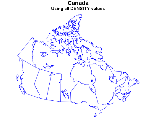
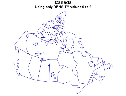
CANADA2 Map before Reduction and CANADA2 Map after Reduction illustrate the effect of reduction on a typical map data
set. CANADA2 Map before Reduction uses observations with all DENSITY values as input to the
GMAP procedure.
CANADA2 Map after Reduction uses only those observations with a DENSITY value of 0
to 2 as input to the GMAP procedure.
The program for these
maps is in Reducing the Map of Canada.
The reduced map shown
in CANADA2 Map after Reduction retains the overall shape of the original but requires
only 463 observations compared to the 4302 observations that are needed
to produce the map in CANADA2 Map before Reduction.
Note: Many of the map data sets
that are supplied by SAS Institute already have been processed by
GREDUCE. If the map data set contains a DENSITY variable, you do
not need to process the data set using GREDUCE.
See also GREMOVE Procedure for more information about how to do the following: