GREDUCE Procedure

Example: Reducing the Map of Canada
| Features: |
ID statement |
| Sample library member: | GRDCANAD |
This example illustrates major
features of the GREDUCE procedure. Because the example uses one of
the map data sets that are supplied with SAS/GRAPH , you might need to replace SAS-data-library in
the LIBNAME statement with the actual location of the SAS library
that contains the Institute-supplied map data sets on your system.
If your site automatically assigns the libref MAPS to the SAS library
that contains the Institute-supplied map data sets, delete the LIBNAME
statement in this example.
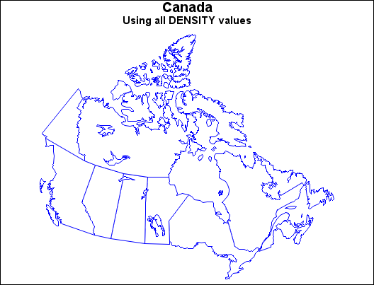
In this example, the
GREDUCE procedure creates the DENSITY variable for the CANADA2 map
data set that is provided with SAS/GRAPH . First, the map is displayed at its original density
by using the GMAP procedure.
Program
goptions reset=all border;
title1 "Canada";
title2 "Using all DENSITY values";
pattern value=msolid repeat=12 color=white;
proc gmap map=maps.canada2 data=maps.canada2 all;
  id province;
  choro province / nolegend coutline=blue;
run;
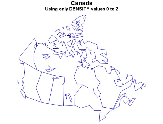
proc greduce data=maps.canada2 out=can2;
   id province;
run;
title2 "Using only DENSITY values 0 to 2";
proc gmap map=can2
          data=can2 all density=2;
   id province;
   choro province / nolegend coutline=blue;
run;
quit;
Program Description
Show the unreduced map. The
ID statement specifies the variable in the map data set that defines
unit areas.
proc gmap map=maps.canada2 data=maps.canada2 all;
  id province;
  choro province / nolegend coutline=blue;
run;
The GREDUCE procedure creates a new map data set, CAN2,
containing a DENSITY variable. The ID
statement specifies the variable in the map data set that defines
unit areas.