Drill or Expand the Geographic Hierarchy in a Geographical Map
The US Regions Hierarchy Level is an example of a geographical map that has geographic
hierarchies defined.
-
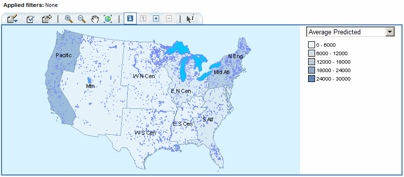
Click
 and then click a colored geographical map region
(which is a member in the currently displayed geographic hierarchy
level). The geographical map is redrawn to display the regions (members)
for the next hierarchy level down while keeping the context of the
current hierarchy level. The legend to the right of the geographical
map changes to display the values for the expanded region.
and then click a colored geographical map region
(which is a member in the currently displayed geographic hierarchy
level). The geographical map is redrawn to display the regions (members)
for the next hierarchy level down while keeping the context of the
current hierarchy level. The legend to the right of the geographical
map changes to display the values for the expanded region.
-
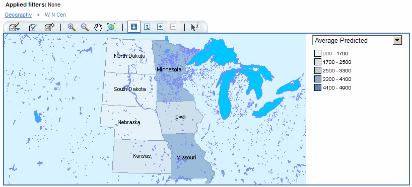
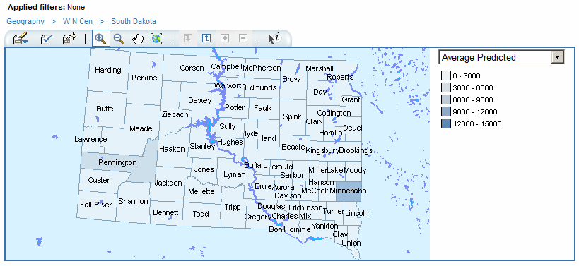
Click
 and then click a colored geographical map region
(which is a member in the currently displayed geographic hierarchy
level). The geographical map is redrawn to display the regions (members)
for the next hierarchy level down. The legend to the right of the
geographical map changes to display the values for the drilled region.
and then click a colored geographical map region
(which is a member in the currently displayed geographic hierarchy
level). The geographical map is redrawn to display the regions (members)
for the next hierarchy level down. The legend to the right of the
geographical map changes to display the values for the drilled region.