Linking the Attribute Data to the Spatial Data
Before you can use your
spatial data as a basis for exploring your attribute data, you must
link the attribute data to the spatial data. After the link is created,
one way to use the attribute data is by creating a theme to control
the appearance of features in the spatial data. See Overview of SAS/GIS Software for more information.
In the layer bar, right-click
the COUNTY layer name to open the pop-up
menu for the COUNTY layer. Select Edit to
open the GIS Layer window. In the definition
for the COUNTY layer, select Thematic. The GIS
Attribute Data Sets window appears for you to define
the link to the theme data set.
In the GIS
Attribute Data Sets window, select New to
define a new link. In the resulting Select a Member window,
select MAPS.USAAC. You must next specify the values that are common
to both the attribute and spatial data. These common values provide
the connection between the spatial data and the attribute data. The
spatial database and the MAPS.USAAC data set share compatible state
and county codes. Given these compatible values, first select STATE in
both the Data Set Vars and Composites lists.
Then select COUNTY in both lists. Select Save to
save the link definition to the Links list.
Finally, select Continue to close the GIS
Attribute Data Sets window.
After the GIS
Attribute Data Sets window closes, the Var window
automatically opens for you. Select which variable in the attribute
data provides the theme data for your theme. Select the CHANGE variable
to have the counties colored according to the level of change in the
county population. Select OK to close the Var window.
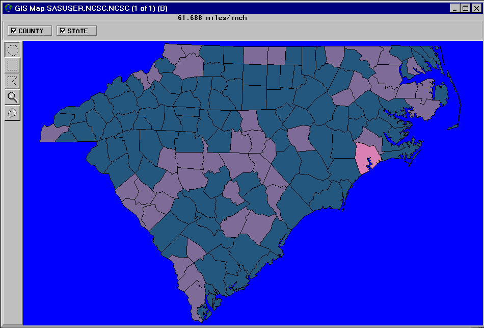
The counties in the
spatial data are colored according to the demographic values in the
attribute data set, as shown in the following display.
Note: The theme ranges in the COUNTY
layer reflect the range of values in the MAPS.USAAC data set, which
contains data for the entire United States. See Chapter 5, “Customizing
Maps,” in SAS/GIS Software: Usage and Reference,
Version 6 for details about how you can select different
theme ranges that are more appropriate for the displayed counties.
Copyright © SAS Institute Inc. All rights reserved.