Geo Maps
Geo Bubble Maps
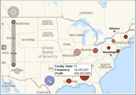
A geo bubble map is
a bubble plot that is overlaid on a geographic map. Each bubble is
located at a geographic location or at the center of a geographical
region. The bubbles are automatically colored based on the location.
You provide a measure data item that determines the size of the bubble.
A geo bubble map requires a data item that contains geographical information
and is assigned to a geography role.
Geo Coordinate Maps
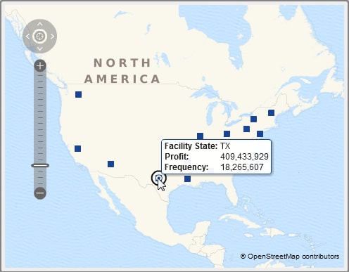
A geo coordinate map
is a simple scatter plot that is overlaid on a geographic map. A geo
coordinate map is used in place of a geo bubble map when the cardinality
is too high and the geo bubble map cannot display the number of points.
Each point in a geo coordinate map is located at the center of a geographic
region or at the coordinates of a location. A geo coordinate map requires
a data item that contains geographical information and is assigned
to a geography role.
Geo Region Maps
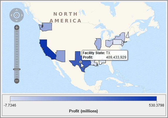
A geo region map (also
known as a choropleth map) is a two-dimensional map that uses color
combinations to represent different categories or levels of magnitude. You
can fill geographical boundaries (for example, a country or a state)
on a map with color, based on measure values that are aggregated to
the level defined by a geographical boundary.
Copyright © SAS Institute Inc. All rights reserved.